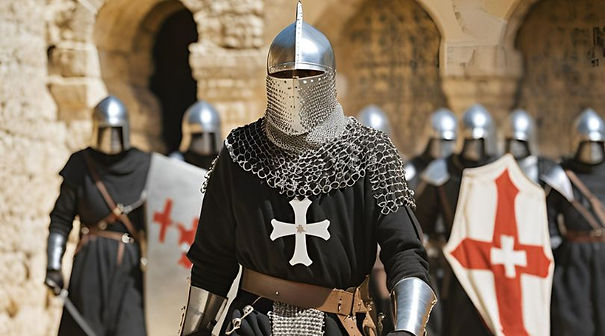
THE KNIGHTS HOSPITALLERS
IN NORFOLK
CARBROOK
The Norfolk village of Carbrooke, recorded as Cherebroc in the Domesday Book, was one of the larger and more prosperous rural settlements in medieval East Anglia. By the late 12th century it had become something far more significant: a major estate and administrative centre of the Knights Hospitaller.
Today, although no medieval buildings remain above ground, the landscape still preserves the imprint of this once-important religious complex.
It is not disputed that Maud, Countess of Clare, granted:
-
The manor of Carbrooke
-
The church of St Peter and St Paul
-
A second church, St John the Baptist
to the Knights Hospitallers in 1182.
This gift established Carbrooke as a preceptory (commandery)—a local headquarters managing lands, income, and religious duties.
However, an intriguing historical question remains unresolved.
Some sources suggest that Maud’s husband, the Earl of Clare (d. 1173), had already begun establishing a preceptory here for the Knights Templar, but died before it was completed or endowed. If so, Maud’s 1182 grant may have transferred an unfinished Templar foundation to the Hospitallers.
Supporting this possibility are:
-
Early 13th-century grave covers in the parish church bearing Templar insignia
-
The scale and sophistication of the site, suggesting early high-status planning
While not proven, this overlap reflects the close and sometimes transitional relationship between the Templars and Hospitallers in the late 12th century.
Carbrooke was not just an estate—it was also a centre of care and devotion. Maud established:
-
A hospital near the second church (St John the Baptist)
-
Staffed by Sisters of the Order of St John
These sisters were later moved to Buckland (Somerset) around 1180, but the site at Carbrooke continued to function under Hospitaller control. By the later Middle Ages, the preceptory:
-
Supported 12 poor persons
-
Combined religious, charitable, and administrative roles
The site of the commandery lies:
-
Immediately south of St Peter and St Paul Church
-
At grid reference TF 951 021
-
Under permanent pasture
It is now a Scheduled Monument, recognised as the, Commandery of St John of Jerusalem (site of)
Although no buildings survive above ground, the earthworks are remarkably informative.
Main platform
-
A large rectangular platform (approx. 76m north–south)
-
Surrounded on three sides by a moat ~12m wide and 1.5m deep
-
A stream runs along the southern side
Within this enclosure:
-
Foundations of a sub-rectangular structure (18m × 13m)
-
Likely part of the main administrative or residential buildings
Surrounding features
-
Fishponds (three) to the west
→ Used for food supply, especially during fasting periods -
Dovecote site
→ A small square moated island, likely for breeding pigeons -
Banks, ditches, and enclosures
→ Indicating additional buildings, yards, and working areas -
Large boundary ditch and bank
→ Running from the churchyard toward Wood Farm
→ Probably marking the outer boundary of the preceptory precinct
A detailed survey of 1388 reveals the scale of Carbrooke under the Hospitallers:
-
420 acres of arable land recorded
-
Meadow, pasture, and woodland
-
A manor with dovecote
-
Two windmills, producing income for the estate
The estate generated wealth through:
-
Rents (cash and produce)
-
Labour services
-
Court fines
-
Agricultural output
-
Religious donations
Notably, the churches of Great and Little Carbrooke together were valued at £40 annually, a substantial sum.
By 1388, Carbrooke had:
-
Two windmills, valued at 40 shillings
These mills were essential:
-
Grinding grain for tenants (who were often required to use them)
-
Generating steady income for the Hospitallers
Their exact locations are unknown, but they would have stood:
-
On high ground
-
Within easy reach of the village and fields
The nearby St Peter and St Paul Church, Carbrooke remains the most visible medieval structure today.
-
Largely 15th century (Perpendicular) in appearance
-
But with earlier fabric surviving
Of particular interest:
-
Two early 13th-century grave slabs
-
Bearing Templar insignia
These provide rare physical evidence of the possible earlier Templar presence at Carbrooke
The preceptory continued in operation until:
-
1540, when it was dissolved under Henry VIII
After this:
-
Buildings were dismantled
-
Materials likely reused locally
-
The site gradually returned to farmland
Although the medieval buildings are gone, the landscape still tells the story:
-
The church remains at the heart of the village
-
The preceptory site survives as earthworks in pasture
-
Field boundaries and features preserve the medieval layout
Visitors standing south of the church today are, quite literally, looking across the site of a 12th-century religious headquarters.
Medieval Carbrooke was far more than a simple farming village. Under the Knights Hospitallers, it became:
-
A major manorial estate
-
A religious and charitable centre
-
A hub of agricultural and economic activity
Its earthworks—moats, fishponds, and platforms—remain a powerful reminder of a landscape shaped by one of the most influential religious orders of the Middle Ages.


TOGYRYND (Barton Mills) -
Barton Mills and the Lost Manor of Togrynd: A Hospitaller Estate on the River Lark
Nestled on the south bank of the River Lark, the village of Barton Mills preserves within its landscape the memory of a remarkable medieval estate—one that combined water power, industry, and religious ownership. Known in early records as “Barton Togrynd”, this lost name offers a rare glimpse into the economic heart of the village: a complex of mills once held by the Knights Hospitallers.
The Meaning of “Togrynd”
In medieval texts, Barton Mills appears under the striking name:
“Barton Togrynd” — meaning “two grind”
This was not a conventional place-name, but a functional description. It referred directly to the presence of multiple mills, likely operating side by side on the River Lark.
Local historical sources confirm that:
-
The name derived from a watermill located in front of the Bull Inn
-
There was also:
-
a windmill
-
and a fuller’s (cloth-processing) mill
-
In other words, “Togrynd” described a multi-mill industrial site, not just a settlement.
The Hospitallers at Barton Mills
The same source reveals a crucial detail:
The mills “were once owned by the Most Venerable Order of the Hospital of St John of Jerusalem”
This identifies the owners as the Knights Hospitallers, one of the great medieval military-religious orders of Europe.
The Manor of Togrynd: What the Hospitallers Held
The Hospitallers document of 1388 describes “Togrynd”, It records a small but economically focused estate:
Key components:
-
1 messuage (manorial house with garden)
-
Arable land (36 acres)
-
Meadow (15 acres)
-
Pasture
-
Two mills:
-
a fulling mill (for cloth production)
-
a water corn mill (for grinding grain)
-
-
Rents and court income
Total annual value: £6 16s
A Hospitaller Industrial Estate
The evidence suggests that “Togrynd” was not the whole village, but rather, A specialised Hospitaller sub-manor centred on the mill complex, Its function:
-
Grind grain (corn mill)
-
Process cloth (fulling mill)
-
Generate rents and fees
From Togrynd to Barton Mills
Over time, the name “Togrynd” disappeared.
The village became known as:
-
Barton Parva (“Little Barton”) in the medieval period
-
Later Barton Mills (18th century)
The newer name reflects:
-
the enduring importance of the mills
-
but in a more conventional form
“Barton Togrynd” is one of those rare medieval names that captures a place’s function with unusual clarity.
It tells us that:
-
Barton Mills was once defined by its twin milling operations
-
These mills formed the core of a Hospitaller manor
-
The estate was:
-
small in land
-
but significant in industry and income
-
In modern terms, the quiet river crossing by the Bull Inn marks the site of what was once a busy medieval industrial hub, owned by one of Europe’s most powerful religious orders.


MELLES (Mellis) - Messuage
The Knights Hospitaller and the Manor of Mellis St John’s
The medieval manor known as Mellis St John’s appears to preserve a direct link between Mellis and the military religious orders of the Middle Ages. Although Mellis was never a full Hospitaller preceptory, it was an outlying estate, or member, of the Knights Hospitaller’s Battisford commandery in Suffolk.
The clearest medieval description comes from the Hospitaller survey of 1338, made under Prior Philip de Thame. In this account, Mellis is listed as “Melles — membrum”, meaning a dependent estate. The holding consisted of one messuage with a garden, 70 acres of land, one acre of meadow, a small piece of pasture, and assized rents from tenants. This suggests a modest but valuable manorial farm and rent-holding rather than a religious house occupied by brothers of the Order.
The estate may have had earlier Templar origins. Antiquarian accounts record that, in the reigns of Henry III and Edward I, the Knights Templar held liberties in Mellis, including rights such as view of frankpledge and the assize of bread and ale. After the suppression of the Templars, many of their English properties passed to the Hospitallers, and Mellis St John’s was later connected with the Order of St John through Battisford.
The exact location of the medieval manor house or principal messuage has not yet been proven. However, the most likely search area is around the western and south-western side of Mellis Common, particularly near Potash Farm, Hall Farm, Cowpasture Lane and the former mill-mound area. This part of Mellis contains known medieval landscape features, including moated sites, and lies close to field-name clues such as Millmount, Crossfield and Ives Acre found in later manorial references.
After the Dissolution, Mellis St John’s passed to the Crown and was granted away in 1554. By the later sixteenth and seventeenth centuries it formed part of the wider Bacon / Redgrave Hall estate complex, while still remaining a distinct manor with its own court rolls and rentals. Records in the Sir Nicholas Bacon Collection include particulars, court rolls and rentals for Mellis St John’s from the mid-sixteenth century onwards.
Today, no standing Hospitaller building is known at Mellis. What survives is a historic landscape: the green, medieval moated sites, ancient farmsteads, field names and documentary traces. Together, these suggest that Mellis St John’s was a small but significant estate within the wider Hospitaller network in Suffolk, linking the village to the medieval world of the Templars, the Order of St John, and the commandery at Battisford.
Costessey - Messuage
Costessey Manor and the Hospitaller Financial Settlement (c. 1221)
A Norfolk manor within royal debt restructuring after the Barons’ War
The transfer of Costessey Manor into Hospitaller hands in 1221 should be read not as an isolated ecclesiastical acquisition, but as part of a wider programme of Crown debt management in the aftermath of the First Barons’ War and the French intervention under Prince Louis.
By this point, Henry III’s administration was still absorbing the financial consequences of the 1215–1217 crisis, in which royal revenues had been disrupted, assets alienated, and substantial sums advanced or guaranteed to sustain the war effort and subsequent restoration of authority.
The 1221 Westminster settlement
A record preserved in Monasticon Anglicanum (9 May 1221, Westminster) states that:
-
The manor of Costessey (Norfolk) was assigned to the Grand Prior of England and the Knights Hospitaller
-
A fixed annual render of £50 was to be paid from the estate
-
This income was explicitly tied to amortising a royal debt of 620 marks
-
The obligation originated in financial arrangements made during the period of Prince Louis’s presence in England
This was not a simple alienation of land, but a structured assignment of manorial income streams against Crown indebtedness, effectively converting a rural estate into a servicing mechanism for royal liabilities.
The financial logic of the arrangement
The structure is characteristic of early 13th-century royal fiscal practice:
-
the Crown retains theoretical ownership
-
revenue-producing manors are assigned to a creditor body
-
fixed annual rents are used to discharge a capital debt over time
In this case, Costessey functions as a monetised estate unit, its £50 annual render forming part of a scheduled repayment against the 620-mark obligation.
For context, this represents a significant but not exceptional manorial valuation within East Anglia, consistent with a productive, mixed agrarian estate rather than a marginal holding.
Costessey as a manorial landscape
The manor itself comprised a typical but substantial Norfolk agrarian complex:
-
a central manorial site (hall and demesne)
-
dependent tenant holdings (messuages and yardlands)
-
open-field arable systems divided into strips
-
meadow and pasture along the River Wensum
The settlement nucleus corresponds to what is now Old Costessey, particularly the zone around St Edmund’s Church and The Street, which preserves the medieval settlement axis.
Within this structure, small holdings such as recorded messuages with c. 4 acres of land would have been embedded in the immediate village field system, rather than dispersed holdings at distance. These were integral components of the manorial economy, not peripheral land grants.
Local tenure and administrative context
Names such as Alexander de Bassingeburn appear in associated documentation, reflecting the layered tenure structure typical of East Anglian manors in this period.
Such figures were:
-
intermediate landholders or sub-tenants
-
embedded within overlapping feudal and seigneurial claims
-
often involved in the formalisation or surrender of rights during reallocation events
Their presence indicates that Costessey was not a simple demesne estate, but a multi-tiered property system with subdivided fiscal and tenurial obligations.
Location in the modern landscape
The medieval manorial core aligns closely with:
Old Costessey (NR8), centred on St Edmund’s Church and The Street
This remains the most plausible location for:
-
the manorial centre
-
tenant settlement clusters
-
and the open-field system that structured the surrounding agricultural land
Modern New Costessey lies largely outside the medieval settlement footprint and reflects later expansion, particularly post-medieval and modern suburban growth west of Norwich.
Duration and subsequent development
The Hospitaller connection to Costessey originates in the 1221 settlement, but like many English manorial assignments of this type, the arrangement should be understood as financial stewardship rather than permanent monastic colonisation.
Over time:
-
the estate would have been managed through local agents or farmers
-
rents collected and forwarded into the wider Hospitaller financial system
-
administrative control likely became indirect rather than resident-based
The manor remained part of the order’s English portfolio until the wider dissolution of monastic property in the 16th century, though its operational character would have evolved significantly long before that point.
Costessey in 1221 represents a clear example of:
-
Crown debt monetisation following wartime crisis
-
assignment of manorial income to a major military-religious order
-
integration of a Norfolk agrarian estate into transnational financial structures
-
and the embedding of local tenurial complexity within royal fiscal repair mechanisms
In this sense, Costessey is less an isolated rural manor and more a functional unit within post-conflict royal financial reconstruction.


Badley - St Marys Church
The Knights Hospitallers and St Mary’s Church, Badley, Suffolk
The medieval church of St Mary at Badley, recorded in Hospitaller accounts as Badelee, formed part of the wider spiritual and economic landscape of the Knights Hospitallers’ preceptory at Battisford in Suffolk. This was not simply a matter of worship: for the Order, churches, pensions, tithes and procurations were valuable sources of income, helping to support the work of the Hospital of St John in England and overseas.
By 1338, in the great survey made under Prior Philip de Thame, the Hospitallers were making payments connected with the church of Badley. The account records:
“Paid for the pension for the church of Badelee, 13s. 4d.; and for the procurations of the churches of Badelee and Batesford, and for cenages, 14s. 8d.”
This means that the Hospitallers were responsible for a fixed annual pension connected with Badley church, together with ecclesiastical charges linked to both Badley and Battisford. A pension in this context was not a person, but a regular payment attached to a church or benefice. Procurations were payments normally connected with church visitation or ecclesiastical administration.
The exact original donor of the Badley church income is not clearly stated in this entry. However, the connection belongs to the Hospitaller estate centred on Battisford, where the Order had been established by at least the reign of Henry II. Suffolk HER notes that in 1338 the Hospitallers held half the church of Battisford, valued at 10 marks per year, and that they also appear to have held the appropriation of the rectory of Badley, valued at £10 per year.
This is significant. If the rectory of Badley was appropriated to the Hospitallers, the Order received the rectorial income of the church, while the cure of souls would usually have been served by a vicar or chaplain. For the Hospitallers, Badley was therefore part of the revenue network attached to Battisford, rather than necessarily a resident commandery site in its own right.
The surviving church of St Mary, Badley remains one of Suffolk’s most atmospheric medieval churches. It is a Grade I listed building, first listed in 1955, and is now cared for by the Churches Conservation Trust. Historic England records the church as Grade I, while the Churches Conservation Trust describes it as one of Suffolk’s most remarkable medieval churches, standing in an isolated valley reached by a long track across farmland.
The building preserves fabric from around 1200, including early medieval features, though much of the present structure is later medieval, especially from the 15th century. Built largely of flint and brick with tiled roofs, it still contains a notably unmodernised interior, including medieval and post-medieval furnishings.
Today, St Mary’s stands as a quiet but important witness to Badley’s medieval parish life and to the wider ecclesiastical holdings of the Knights Hospitallers in Suffolk


Little Carbrooke - Ville & Medieval Church (No Longer Standing)
The Knights Hospitaller at Little Carbrooke
Little Carbrooke, known in medieval records as Parva Kerbrock, was closely linked to the Knights Hospitaller through its church and early hospital.
In the late twelfth century, Maud, Countess of Clare, granted the church of St John the Baptist, Little Carbrooke, to the Hospitallers as part of the wider Carbrooke estate. The dedication to St John the Baptist, patron of the Order, made it a natural part of their religious and charitable work in Norfolk.
Little Carbrooke also briefly housed Hospitaller sisters in a small hospital near the church. This community was later moved to Buckland in Somerset, but Little Carbrooke continued to provide an annual payment of 13s. 4d. to Buckland.
By 1338, the rectory of Little Carbrooke remained an important source of income for the Hospitaller commandery at Carbrooke. The medieval church has now disappeared, but its likely site lay near Ovington Road, between Drury Laneand the River Wissey.
Little Carbrooke was therefore a small but significant Hospitaller holding: a lost church and hospital site connected with worship, charity, and the early female branch of the Order of St John
BAMBURGH
Bawburgh, Norfolk — “Bamburgh” and the Knights Hospitaller
Bawburgh, west of Norwich, appears in medieval Hospitaller records under the form “Bamburgh” or “Bamburgli”. This should not be confused with Bamburgh in Northumberland. The Norfolk place is best identified with modern Bawburgh, a village in the valley of the River Yare, close to Costessey.
In the 1338 return of Prior Philip de Thame, the Knights Hospitaller commandery of Carbrooke recorded property at “Bamburgh”. The entry states that the Order held 50 acres of land, valued at 6d per acre,
producing 25 shillings a year. It also held 14 acres of meadow, valued at 2 shillings per acre, producing a further 28 shillings. Together, the Hospitaller estate at Bawburgh was worth 53 shillings annually.
This was a useful agricultural holding rather than a separate Hospitaller house. No preceptory, chapel, hospital, or resident brethren are known at Bawburgh. The land was almost certainly administered from Carbrooke, the main Hospitaller commandery in Norfolk, and formed part of its wider estate network.
Bawburgh itself was an important medieval settlement. Domesday Book records it as a valuable manor connected with Costessey, with ploughland, meadow, woodland, and mills. In the Middle Ages it also became known as the burial place and shrine of St Walstan, an East Anglian saint associated with farming, healing, and pilgrimage. His well and the church of St Mary and St Walstan remain central to the village’s historic identity.
The Hospitaller lands at Bawburgh therefore sat within a productive and sacred landscape: fertile arable fields, valuable river meadows, mills on the Yare, and a church visited by pilgrims. Although no visible Hospitaller building survives, the 1338 record shows that Bawburgh was one of the places in Norfolk whose land helped support the military and charitable work of the Order of St John of Jerusalem.
WODEHALL -
Wodehall, Norfolk — The Knights Hospitaller and Carbrooke
Wodehall, written in the Hospitaller record as “Wodehall”, is best identified with Woodhall in Carbrooke, Norfolk, rather than a separate village. It appears in connection with the preceptory of Carbrooke, the principal house of the Knights Hospitaller in Norfolk.
The surviving reference is brief. In the 1338 return of Prior Philip de Thame, the Carbrooke account includes the phrase:
“Et aule de Wodehall iij d. ob.”
This translates as:
“And to the hall of Wodehall, 3½ pence.”
This was a very small annual payment, probably a quit-rent or manorial due owed in connection with the neighbouring manor or hall of Woodhall. The wording does not show that the Hospitallers owned Wodehall outright, nor that they had a separate house, chapel, or resident brethren there. It shows instead a legal or manorial relationship between Carbrooke commandery and Woodhall manor.
Carbrooke itself had been founded for the Order of St John in the later 12th century. Local tradition and parish history associate its foundation with Maud, Countess of Clare, who gave the church to the Hospitallers, establishing the religious and administrative centre that later became Carbrooke Commandery.
Later records preserve Woodhall as a separate manorial name within Carbrooke. Nineteenth-century descriptions still refer to lands in the manors of Carbrooke, Woodhall, and the Knights Hospitallers of St John of Jerusalem, showing that Woodhall remained a recognised local manor long after the medieval commandery had disappeared.
After the Dissolution, the former Hospitaller site, manor and rectory of Carbrooke were granted in 1543 to Sir Richard Gresham and Sir Richard Southwell. The commandery site, close to the church of St Peter and St Paul, survives today only as earthworks and buried remains, while Woodhall’s name is preserved in the Carbrooke manorial landscape rather than in a surviving Hospitaller building.
In summary, Wodehall was not itself a known Hospitaller preceptory, but a neighbouring manor or hall connected to Carbrooke by a small annual payment. The surviving evidence points to a modest manorial obligation, not a major estate.